Coastway is an Irish chartered surveyor that specialises in creating detailed maps of plots of land in preparation for construction.
Until recently, it did this by sending out employees with GPS tracking devices. They would stand at various points in a given plot and record their GPS co-ordinates.
This was a laborious process, recalls chief technology officer Niall Kane. “GPS is a very slow and rudimentary method as you're only able to mark a couple of hundreds points in a day," he explains. "When surveying a quarry, for example, which is always changing, it takes so long to get from one side to the other that your calculations are affected.”
Kane says that Coastway considers itself an innovative company. “Coastway will always be at the forefront of technology and stay ahead in terms of different software and hardware solutions,” he says.
In the surveying industry, the goal of innovation is to do things “quicker, better and faster”.
Last year, the search for a faster and more cost-effective approach led it to acquire an unmanned aerial vehicle, or drone.
The company bought a swingletCAM UAV made by a company called senseFLY. The UAV can be programmed to fly in a predetermined pattern for about 20-minutes each flight.
"It looks like a big crow that hovers over you and doesn't make any sound," Kane says. "You can see why the military has used them for years as you don't even notice it.
“Even the crows are looking at it thinking 'that's a weird looking crow'."
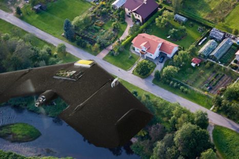
The UAV comes equipped with an onboard Canon 12-megapixel camera, allowing it to take around 200 top-down aerial photos or digital terrain models per flight.
An operator interacts with the drone in-flight using a touch-screen tablet device, linked to the UAV via a radio aerial. They can use the tablet to upload new flight paths, in case there is a change of plan, or they can check the photos as they are taken.
"You see a quick snapshot of the picture the UAV has taken in order to assess the exposure of the camera," Kane says. "If you're flying and notice the pictures are underexposed, you can tell it to come home and fly later.”
However, the tablet that originally shipped with the UAV was too heavy, had limited functionality and suffered from poor battery life. "We needed a device that could keep up with an entire survey day of eight hours,” explains Kane.
It therefore decided to replace it with a CL910 10.1" Windows 7 tablet, made by Motion Computing. The tablet’s Intel Atom processors allows the battery to last all day, says Kane. A stylus allows is to be used in cold weather, he says, while Gorilla Glass screen and rubber coating make it more suitable for use on a building site.
Once the flight is complete, the survey team can immediately retrieve the photographs and modeling data from the on board SD card. This gives it much faster access than when it was still using GPS devices.
Since it started using the drone last year, Coastway has found new applications for the technology. For example, attaching an infra-red sensor allows it to assess the health of crops – plants showing up with a pink tint on photographs are healthy, whereas those that appear black are unhealthy.
"We can map forests for some clients in Ireland who want to assess if there is any contamination or disease in the forest," Kane says. "And we also map legal activity to gather evidence of illegal dumping."
Coastway is now working on a pilot project to use the drone to identify heat-loss from buildings.
For the core business alone, the UAV has been transformational, Kane says. "We're able to do maybe three quarries in a day, compared with one in half a week."
It is also safer than sending staff out into a site. “UAVs are safer than GPS because you don't have to operate physically in the quarry. Furthermore, it has given Coastway an edge on its competitors. “We’ve moved from GPS to UAV at least a year ahead of the market.”


